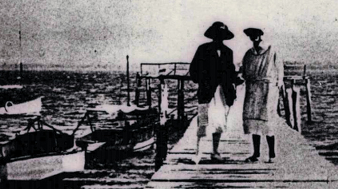
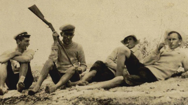
Relaxation on King Island, 1909. Photo: Supplied.
BY JILL GREENHILL, WYNNUM MANLY HISTORICAL SOCIETY
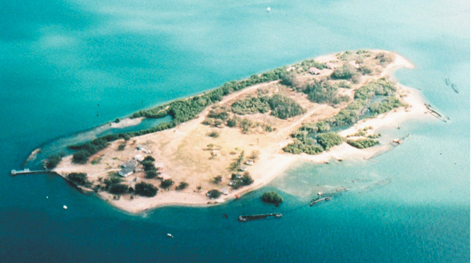
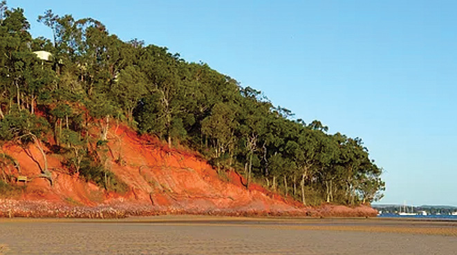
Erobin is the Aboriginal name for King Island, which is only an island at high tide.
King Island, or Erobin, is a mass of dead coral, pebbles and sand settled out from Wellington Point on a broad flat plate. When the tide is out, millions of crustaceans, tiny crabs, limpets and grey mud whelks surround the island. As the water rises, at about 2cm depth, larger crabs quickly emerge and then disappear, camouflaged by the wet mud.
Coarse beach grass stabilises the ground above high tide where small shrubs grow. Nearer the water there are Grey Mangroves, with their vertical above-ground roots uncovered during each tide change.
When the tide is out, there is an easy walk, gentle underfoot, along a sand bar laid down in a long, narrow “s” curve which commences at Wellington Point and continues far beyond the island in a single sweep out into the bay. Scores of visitors walk out at low tide; the game is to hurry back to safety at Wellington Point, and over the last dip before the rising water covers the pathway and is swirling around one’s ankles, then up to one’s knees.
This island was named No. 4 Island by Lieutenant Flinders who entered and named Moreton Bay in 1799. Mud, St Helena and Green Islands were named Nos. 1, 2 and 3 accordingly. The island’s outline appears on the chart of John Gray in 1824, appearing as a rather larger area than today.
In the1860s and 1870s the multitude of visiting campers denuded the trees for their campfires. The trees died leaving the coral cay unstable. Underlying sand and stones were gradually washed away by the tides.
The first attempt to save the shrinking island is noted in the Government Gazette of February 1887 when the island was proclaimed as a “Reserve for Recreation”. Later, in 1975, the island was said to be an “Environmental Park”.
The island and its foreshores lie within the Moreton Bay Wetlands, which is one of the Australia’s Ramsar sites, protected by the Ramsar Convention. This convention was the first modern convention designed to conserve the world’s natural resources, and on 2 February 1971, the first site was declared at the small Iranian town of Ramsar. This protection is of international significance in the conservation of natural biodiversity and halting the loss of world-wide wetlands and preserving and managing those still in place.
The Ramsar site includes the offshore sand islands and surrounding mangroves, intertidal mudflats, marshes, sandflats, coral reefs and seagrass beds. Around King Island there are extensive intertidal areas that are valuable for supporting waterbirds and fauna of conservation significance, as well as providing important nursery conditions for fish and crustaceans. So the island is now titled a “Conservation Park”, just one hectare of mangroves with shore and dune vegetation, surrounded by Moreton Bay Marine Park and included within the Moreton Bay Ramsar site.
There can be no development; the location is to be maintained in its natural condition. Prickly Pear first came to Australia in 1788 and was introduced to King Island to stabilise and reduce the soil loss caused by tides and wind, but by 1920 the Pear was overrunning the natural vegetation. Introduction of the cactoblasts moth, to eat and kill off the Pear, was unsuccessful. Volunteers are slowly removing the Pear, now a declared weed, from the island. Ironically the Pear does assist in the regeneration of young native plants as visitors are temporarily kept away by the prickles. The new native seedlings do not become trampled before they have time to become established.
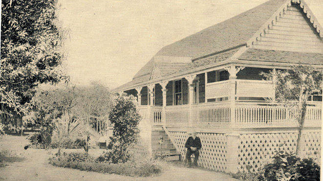
Infantile Paralysis (Poliomyelitis) is a disease little heard of today. In 1903 there was no known treatment. Patients were advised to live a healthy life and bathe daily in warm salt water. The Phillips family, who lived at Hamilton Heights had a young daughter, Jo, who contracted the disease. Being a sailing family, they explored the bay for somewhere to live, and decided to move to King Island. They stayed there for 16 months.
Mr Phillips was the manager of the Brisbane branch of the Commercial Bank of Sydney. He continued working in Brisbane and travelled each day by boat to Wellington Point, took a lift to the station and then a train ride, arriving for a daily 9.00am start. Similarly, he returned home to the island around 6.00pm in the evening, often in the dark. Mother Phillips, left on the island with seven children and a maid, is known to have been a very good cook and always full of energy.
Clarrie Phillips, brother to patient Jo, was another of the family’s seven children. In 1980, at the age of 89, he wrote of his memories of the time spent on the island, from December 1904 to April 1906. Here are snippets from his writings.
“We spent 16 lovely months there… Daily, the children were swimming, boating and fishing. The fish were plentiful, as were oysters and crabs and these became the stable diet of the family. There was no fresh water on the island so ‘Old Mr Radford’, who had a stall on the Point, was engaged to carry water over to us. At low tide he came in his trap, drawn by his faithful horse ‘Duke’. The track across was fairly good as the coral pieces, pebbles and shells made a pretty good surface.”
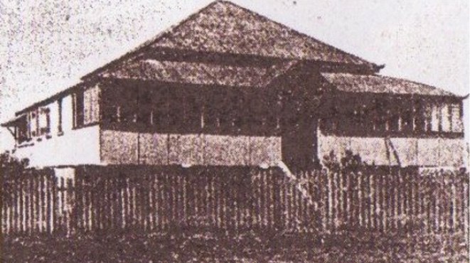
But time was not all spent in play. The older children attended school. Clarence, Cyril and Bruce, aged 13, 11 and 7 years respectively, are recorded on the Wellington Point State School roll in 1905. Their address is “Camped on King Island”, and father’s occupation, “Bank Manager”.
Clarrie noted with amazement, when writing in the 1980s, that the island had shrunk, saying that, “…more than half of the island has disappeared. The reason for that, was the action of the local council, in the 1930s. They cut down all the surrounding mangrove trees and the land washed away. The sandspit to Wellington Point has built up very considerably over time. We used to be cut off for three hours at each high tide.
“Sleeping quarters consisted of a large marquee with a wooden floor and a bell tent for the boys. The maid had a separate tent. The dining room/kitchen was under a large cottonwood tree and was protected by a galvanized roof. There was a colonial oven and a lean-to with an open fire and a camp oven”.
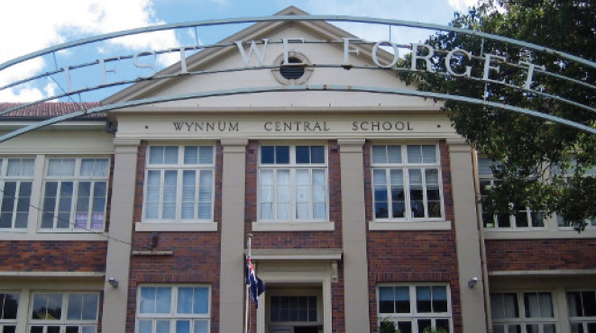
The whole letter is available to read in the resources room of Wynnum Manly Historical Society located in the Wynnum Community Centre (the old Wynnum Central State School building) at 105 Florence Street, Wynnum. The room is open weekdays between 10am and 12noon.